
Windward Islands · Saint Lucia
- Position
- 14.0°N · 61.0°W
- Region
- Saint Lucia
Overview
An island shaped by volcanoes
Saint Lucia is an independent island nation in the Windward Islands, between Martinique to the north and Saint Vincent to the south. Its capital, Castries, sits on the northwest coast, and the island's most famous landmarks, Gros Piton and Petit Piton, rise above the sea on the southwest coast near Soufrière.
Almost every charter here explores the sheltered Caribbean coast. Rodney Bay in the north is the island's main marina and the traditional finish of the Atlantic Rally for Cruisers each December. Marigot Bay, a little south of Castries, is a narrow, palm-fringed inlet and a renowned hurricane hole. From either, a day charter typically cruises south past coves and fishing villages to Soufrière and the Pitons, with snorkel stops along the way.
The Pitons and the sea around them are part of the Pitons Management Area, inscribed as a UNESCO World Heritage Site in 2004. It is a lived-in landscape of villages and resorts rather than a wilderness, and the waters off Soufrière are carefully managed.
Rodney Bay Marina
An IGY marina in an enclosed lagoon in Gros Islet, on the northwest coast, with customs and immigration on site. December is busy with transatlantic rally arrivals. Pigeon Island and Reduit Beach are close by.
Marigot Bay
A sheltered inlet south of Castries with a marina beside the resort, a natural starting point for cruises south toward Soufrière. Its inner bay is a well-known hurricane hole.
Soufrière itself has no marina; visiting yachts use the moorings of the Soufrière Marine Management Area. Castries is a cruise and commercial harbor rather than a charter base.

The west coast
North to south, to the Pitons
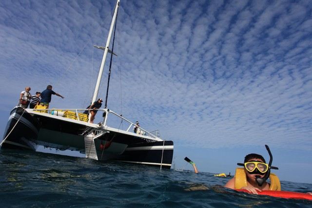
Your captain will plan stops around the sea state and the marine park's rules; mornings are usually calmest for snorkeling.
Pigeon Island National Landmark
A former islet joined to the mainland by a causeway, with the ruins of Fort Rodney and a sheltered beach suited to beginner snorkelers. It is managed by the Saint Lucia National Trust.
Anse Cochon
A small beach with good visibility and reef close to shore, a popular snorkel stop between Marigot Bay and Soufrière.
Anse Chastanet & Anse Mamin
Rainforest-backed beaches with reef starting just offshore, inside a protected marine reserve where snorkeling requires a permit and boats keep out of the swim zone.
Soufrière & the Pitons
Gros Piton (798 m) and Petit Piton (743 m) rise above the town and the bay. The view from the water is unforgettable.
Sugar Beach
A beach between the two peaks, listed by the tourism board for swimming and snorkeling. Land access is through a resort, so arriving by boat is often the practical option; we confirm current arrangements.
Marine rules
The Soufrière Marine Management Area
The coast from Anse Cochon to Gros Piton is managed by the Soufrière Marine Management Area (SMMA). Anchoring is tightly controlled, and is generally not allowed outside designated zones. Visiting yachts use SMMA mooring buoys, with a conservation permit bought from uniformed rangers who patrol daily. Diving and snorkeling inside the marine reserve zones also require a permit.
For a private charter, the operator normally handles permits and moorings; we confirm whether fees are included in your quote. Please use reef-safe sunscreen and never stand on or touch coral.
Moorings, not anchors
SMMA moorings with a ranger-issued permit.
Reserve permits
Required for snorkeling and diving in reserve zones.
Reef-safe sunscreen
Protects the reefs you'll swim over.
Use official moorings
Ask for an SMMA mooring rather than a private one.
Seasons
When to visit
Dry season: December 1 to May 31, the most popular time for charters.
Wet season and hurricane season: June 1 to November 30, with Atlantic hurricane activity peaking from mid-August to mid-October.
Water: about 26–29 °C year-round.
Neighbors: Martinique and Saint Vincent and the Grenadines are separate countries, so sailing to them is a multi-day trip with customs and immigration clearance.
For your St. Lucia quote
- Date, group size and charter length
- Where you are staying: north, Marigot Bay or Soufrière
- Pitons cruise, snorkeling, sunset or a celebration
- Interest in multi-day sailing
Current fleet & availability
Ask about yachts in St. Lucia
Tell us your dates, group size and where you are staying, and whether you would like a Pitons cruise, snorkeling or a sunset sail. We will check the vessels available.
Related destinations
More of the Eastern Caribbean
St. Lucia FAQ
Frequently Asked Questions About Yacht Charters in St. Lucia
Straight answers to the questions travelers ask most about chartering in St. Lucia. If yours is not here, ask us when you request a quote.
Where do St. Lucia charters depart?
Mainly from Rodney Bay Marina in the north or from the marina in Marigot Bay on the west coast. Soufrière has no marina, so charters cruise there rather than departing from it.
Can we see the Pitons by boat?
Yes. The Pitons rise from the southwest coast near Soufrière, inside the UNESCO-listed Pitons Management Area, and cruising beneath them is the highlight of most west-coast charters.
Are there marine park fees near the Pitons?
Yes. The Soufrière Marine Management Area charges for mooring permits and visitor access. The operator normally handles them, and we confirm whether they are included in your quote.
Can boats anchor beneath the Pitons?
Anchoring is generally not allowed in the Soufrière Marine Management Area outside designated zones. Boats use official moorings instead.
Where is the best snorkeling in St. Lucia?
Anse Chastanet, Anse Mamin, Anse Cochon, Sugar Beach and Pigeon Island are the best-known spots. Some are inside marine reserve zones that require a permit.
Can we visit Sugar Beach?
Sugar Beach lies between the Pitons. Land access is through a resort, so many visitors arrive by boat. We confirm current arrangements for your charter.
What is the best time of year for a St. Lucia charter?
The dry season from December to May is the most popular. June to November is the wet season and coincides with the Atlantic hurricane season.
Can we sail to St. Vincent or the Grenadines?
Yes, on a multi-day charter, but it involves crossing an international border with customs and immigration clearance.
How tall are the Pitons?
Gros Piton rises to 798 m and Petit Piton to 743 m. Both are volcanic plugs that stand straight from the sea just south of Soufrière, with Sugar Beach between them.
What is there to see at Pigeon Island?
Pigeon Island National Landmark, beside Rodney Bay, has the ruins of Fort Rodney and a sheltered beach suited to beginner snorkelers. Once an islet, it is now joined to the mainland by a causeway and is managed by the Saint Lucia National Trust.
How warm is the water in St. Lucia?
About 26 to 29 °C year-round. Mornings are usually calmest for snorkeling, and your captain will plan swim and snorkel stops around the sea state and the marine park's rules.